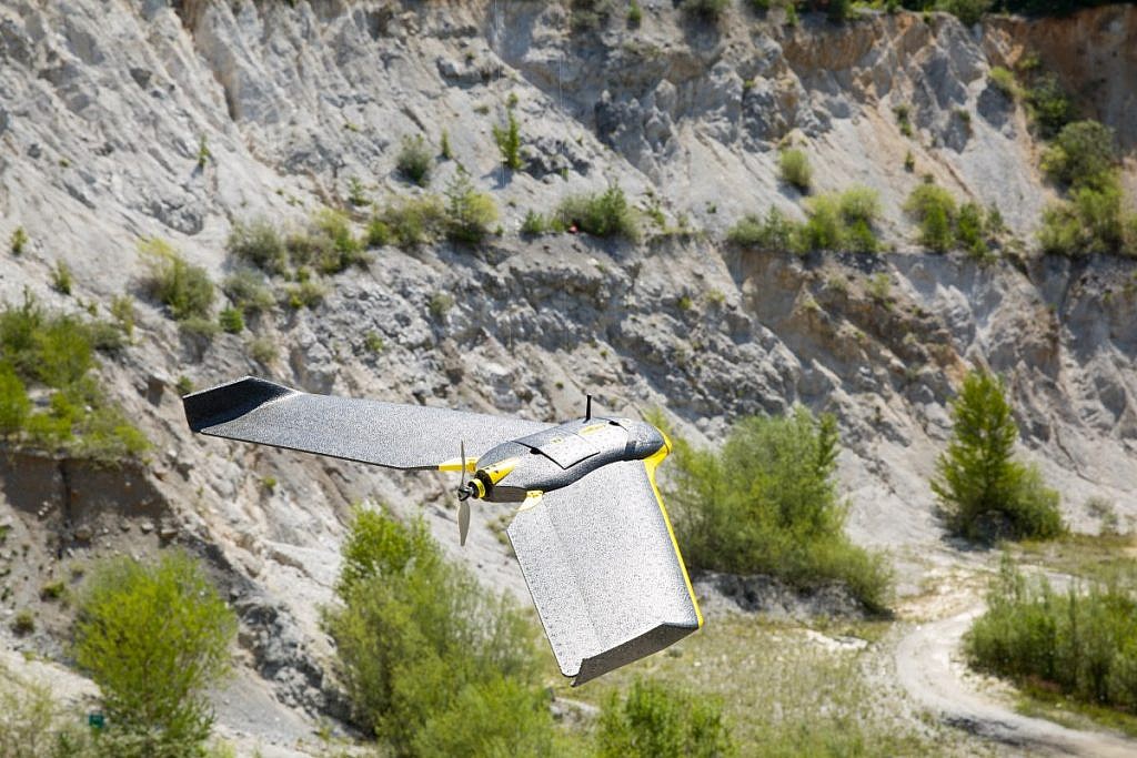
If you are inspired by the world of small unmanned aerial vehicles and would like to better understand the professional concepts of their operations, Geavis has collected a glossary of common expressions and abbreviations designed to brush up on your existing knowledge and help you better communicate with a professional drone operator.
The following are terms often used in relation to unmanned aerial vehicles, their operation and the industries they operate in, specifically aerial survey, construction, and agriculture.
- Above Ground Level (AGL): this term is typically used when describing a drone’s flight height.
- Above Mean Sea Level (AMSL): AMSL altitudes are relative to a standard mean sea level geoid.
- Above the Takeoff Altitude (ATO): ATO altitudes are relative to the place your drone started its motor just before takeoff.
- Aeronautical Information Publication (AIP): In aviation, an Aeronautical Information Publication (or AIP) is defined by the International Civil Aviation Organization as a publication issued by or with the authority of a state and containing aeronautical information of a lasting character essential to air navigation.
- Airport Reference Point (ARP): the centre point of an airport, located at the geometric centre of all the usable runways. The ARP is computed as a weighted average of the end of runway coordinates.
- Background Map: a visual 2D map of a region featuring landforms, roads, etc., onto which additional data is layered. Often used in the field of GIS. Sometimes called a base map.
- Beyond Visual Line of Sight (BVLOS): an operating method whereby an unmanned aircraft is flown beyond the visual line of sight of the operator.
- Check Point: a surveyed point on the ground, used to verify the accuracy of photogrammetric outputs such as DSMs, point cloud, mesh, orthomosaic and DTM.
- Contour Map: a topographic map that delineates surface elevation using contour lines.
- Control Zone (CTR): in aviation is a volume of controlled airspace, normally around an airport, which extends from the surface to a specified upper limit, established to protect air traffic operating to and from that airport.
- Drone: an unmanned aircraft that can navigate autonomously, without human control or beyond the line of sight.
- Digital Surface Model (DSM): a 3D model of an area that includes the tops of buildings, trees, and other ground-based objects.
- Flight Log: a digital record of a single flight that is generated automatically.
- Ground Control Point (GCP): a location or object on the ground that has precisely known coordinates. Used to improve the precision of DSMs created by photogrammetric analysis of a series of images. More
- GeoTIFF: a public domain metadata standard that allows georeferencing information to be embedded within a TIFF image file.
- Geographic Information System (GIS): a system that lets users visualise, question, analyse and interpret data to understand spatial relationships, patterns, and trends.
- Global Navigation Satellite System (GNSS): a satellite navigation system with global coverage, such as GPS, GLONASS, and the European Union’s Galileo system.
- Global Positioning System (GPS): refers to the United States NAVSTAR Global Positioning System, a space-based navigation system that provides location and time information anywhere on or near the Earth.
- Ground Sampling Distance (GSD): the distance between two consecutive pixel centres measured on the ground. More
- Inertial Measurement Unit (IMU): an electronic device used to manoeuver aircraft, which detects changes in acceleration and rotation. Comprised of sensors such as accelerometers, gyroscopes and sometimes magnetometers.
- Keypoint: an identifiable point in an image. The process of photogrammetry involves the matching of common keypoints on two or more images.
- Keyhole Markup Language (KML): an XML notation for expressing geographic annotation and visualisation within internet-based, two-dimensional maps and three-dimensional Earth browsers.
- Light-emitting Diode (LED): a semiconductor device that emits light when an electric current is passed through it.
- Light Detection and Ranging (LiDAR): a remote-sensing technology that measures distances by illuminating a target laser and analysing the reflected light.
- Magnetometer: a geophysical instrument that measures the strength of the Earth’s magnetic field. Used to alongside sensors such as gyrometers and accelerometers to determine an aircraft’s altitude (it’s orientation relative to the Earth’s horizon).
- Metadata: a set of data that describes other data. In the case of a photo, metadata might include: where an image was captured (i.e. its geographic coordinate), who captured it, the camera used and more.
- Notice To Airmen (NOTAM): a notice containing information essential to personnel concerned with flight operations but not known far enough in advance to be publicized by other means.
- Orthophoto: an aerial image where the effect of the central projection has been removed (orthorectified) according to the DTM and the orientation of the image. Refers to a single image from a satellite, aircraft or drone. More
- Pitot Probe: the instrument on an aircraft that measures air pressure in order to calculate airspeed.
- Point Cloud: a set of data points in a 3D coordinate system. These points are typically defined by X, Y and Z coordinates and additional information such as intensity, RGB value or class. More
- Raster Data: in its simplest form, a raster consists of a matrix of cells (or pixels) organised into rows and columns (or a grid) where each cell contains a value representing information, such as RGB value, altitude or temperature. Drone-captured digital photographs are rasters.
- Vector Data: a representation of the world using points (e.g. featuring x, y, z coordinates), lines and polygons. Useful for storing data that has discrete boundaries such as country borders and parcels of land.
Are there any terms you use frequently that we missed? Let us know in the comments section below.
